 2/5
2/5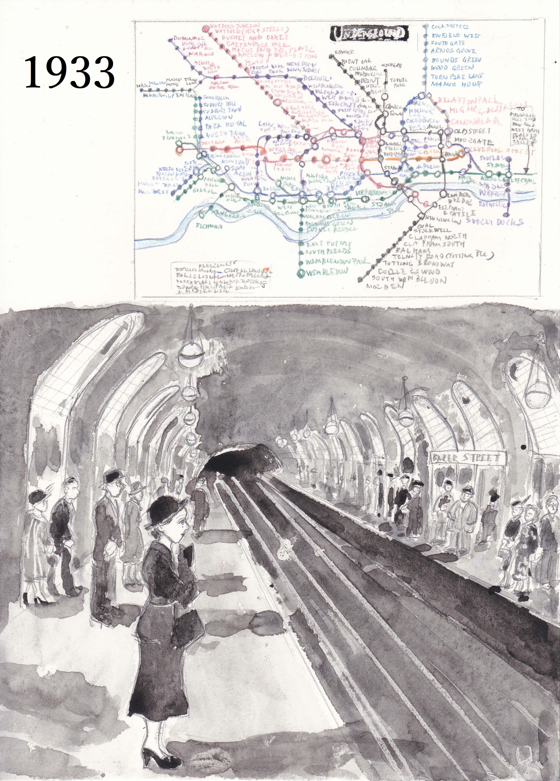 3/5
3/5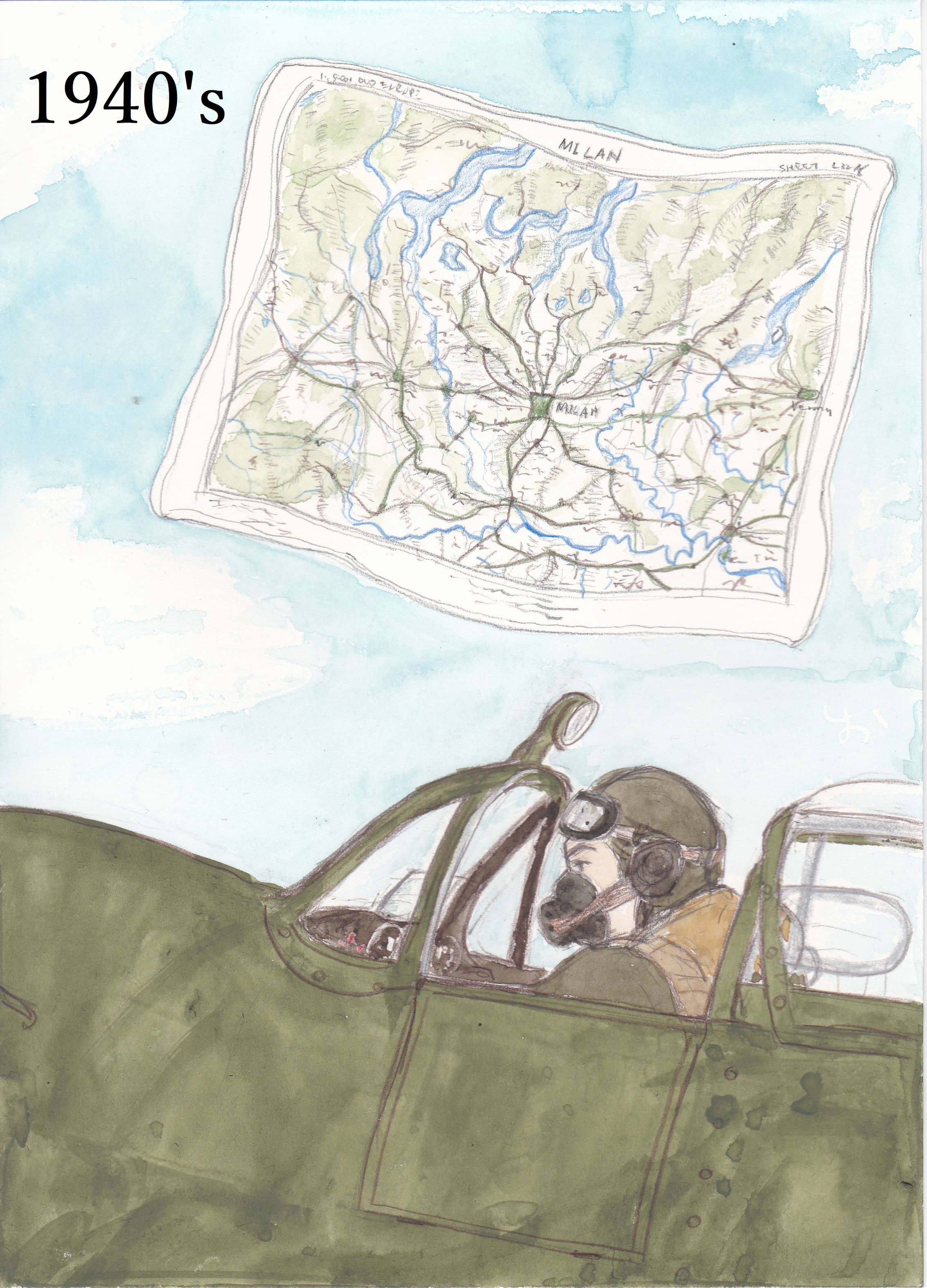 4/5
4/5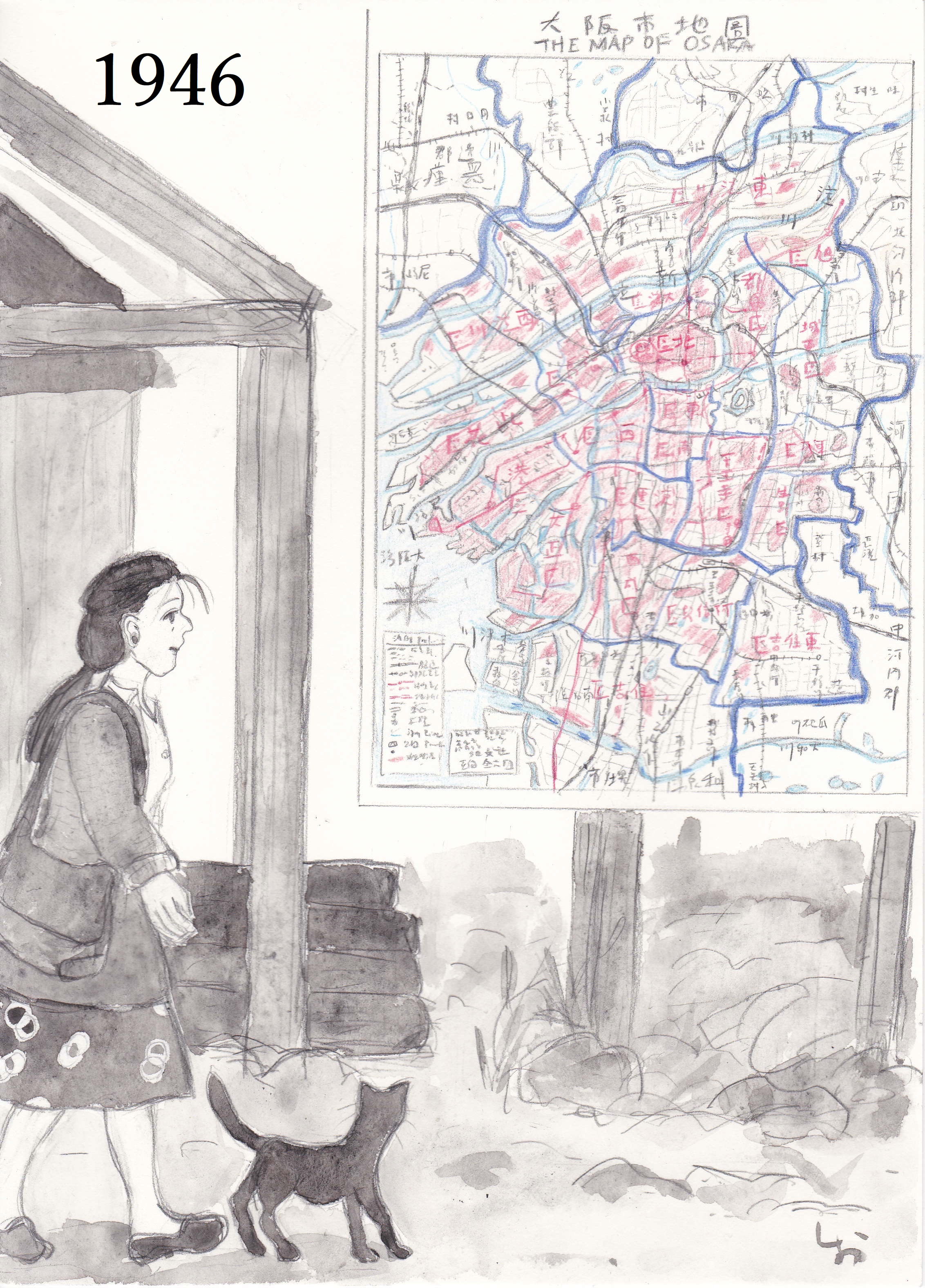 5/5
5/5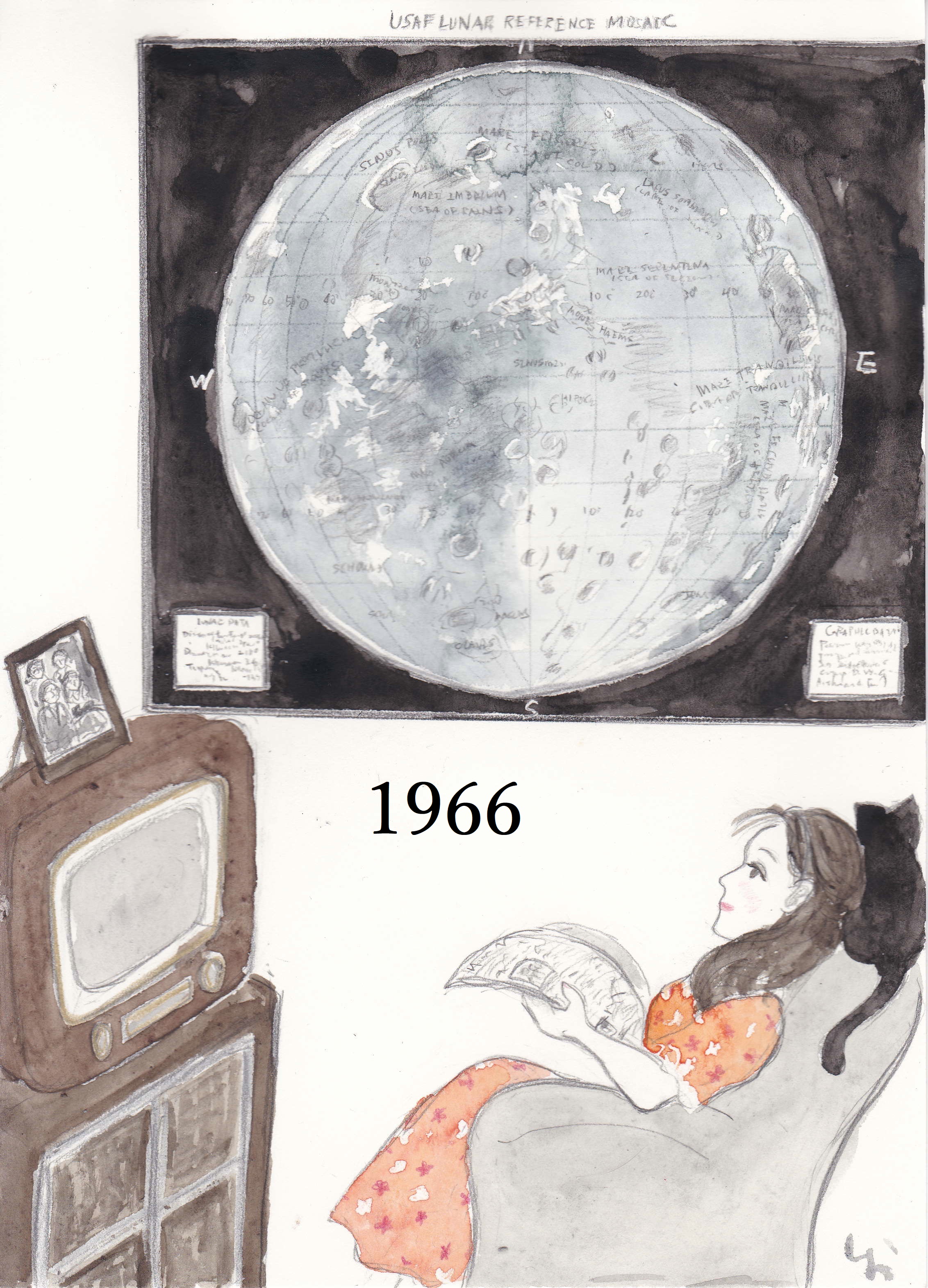
 しお41810
(Welcome to the world of maps part4)
この作品では地図の魅力について描く。 時代とともに地図も様々な目的に使われるようになってきた。
This work depicts the charm of maps. Maps have come to be used for various purposes over time.
这部作品描绘了地图的魅力。随着时间的推移,地图已被用于各种目的。
----------
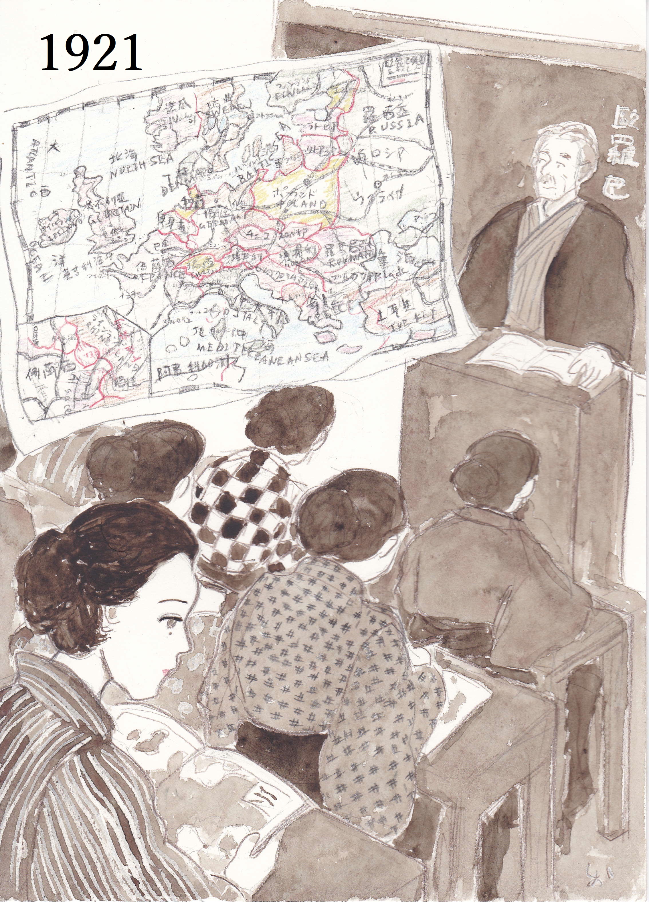
1921
学校教育のための世界地図帳が日本で初めて出版された。
The world atlas for school education was published for the first time in Japan.
学校教育世界地图集在日本首次出版。
1933 London underground by Harry Beck
地下鉄職員ハリー・ベックが作ったロンドン地下鉄路線図。これを最初自費出版したところ評判が良くて正式採用されたとのこと。
A map of the London Underground, created by Underground employee Harry Beck. When he self-published this, it was well received and was officially adopted.
伦敦地铁地图,由地铁员工 Harry Beck 绘制。当他自行出版时,受到好评并被正式采用。
1940's
第二次大戦中、連合国では空軍パイロットに飛行区域の地図を印刷した絹のスカーフを支給した。撃墜された際に敵地から脱出できるように。
During World War II, the Allies supplied Air Force pilots with silk scarves printed with maps of the flight area. To be able to escape from enemy territory when shot down.
二战期间,盟军向空军飞行员提供印有飞行区域地图的丝巾。被击落时能够逃离敌方领土。
1946
敗戦翌年の大阪市。地図中ピンクに塗られている箇所は空襲により焼失した地域だ。
Osaka City, the year after the defeat in World War II. Areas painted pink on the map are areas that were destroyed by air raids.
二战战败后的第二年,大阪市。地图上涂成粉红色的区域是被空袭摧毁的区域。
1966
NASA(アメリカ航空宇宙局)による月面着陸地図 (続く)
Lunar map by NASA (National Aeronautics and Space Administration)(To be continued)
NASA(美国国家航空航天局)的月球地图
(未完待续)
【参考資料(references)】
「地図の物語 人類は地図で何を伝えようとしてきたのか(アン・ルーニー、日経ナショナルジオグラフィック社)」
「世界の美しい地図(MdN編集部編)」
「戦災焼失区域明示 大阪市街図(1946年 知文社)」
「最新基本地図2017(党率100周年記念特別版)世界/日本(帝国書院)」
2023-04-15 03:46:18 +0000