 2/6
2/6 3/6
3/6 4/6
4/6 5/6
5/6 6/6
6/6
 しお41810
(Welcome to the world of maps part2)
この作品では地図の魅力について描く。人類の長い歴史の中で様々な地図が作られた。
This work depicts the charm of maps.Various maps have been created in the long history of mankind.
这部作品描绘了地图的魅力。在人类漫长的历史中,创造了各种各样的地图。
----------------
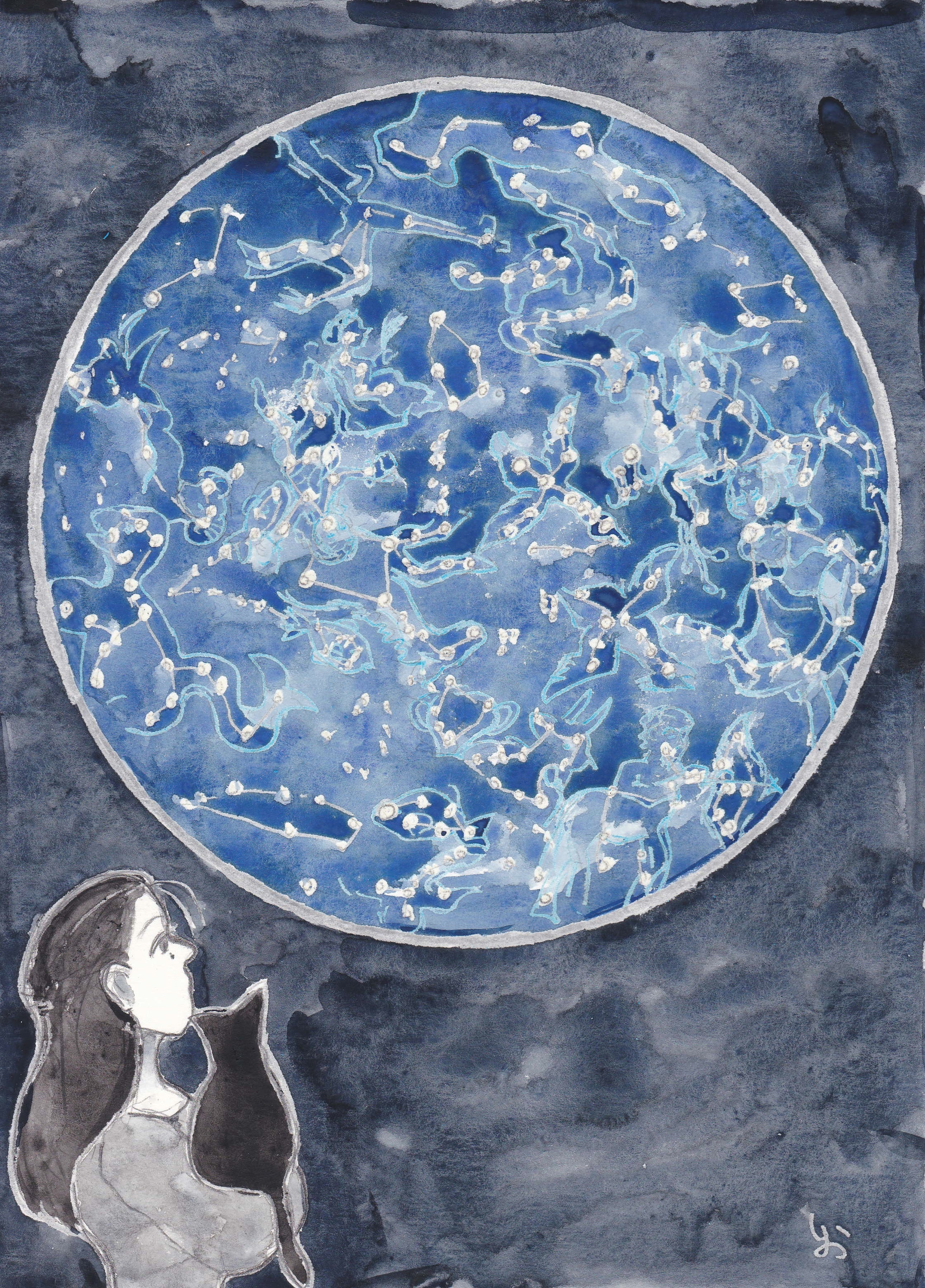
星図も地図の一種である。現代でも私達は星空の中に古代の神話の登場人物を見出している。
A star map is also a type of map. Even today we find ancient mythological characters in the starry sky.
星图也是一种地图。即使在今天,我们也能在星空中找到古代神话人物。
The Bedolina MAP BC.6C~4C(ベドリーナ図)
古代の地図は自分達が住む集落を描く岩絵から始まったようだ。
It seems that ancient maps began with rock paintings depicting the settlements in which they lived.
古代地图似乎始于描绘他们居住的定居点的岩画。
禹跡図/うせきず/Yu Ji Tu (1137年)
大河の氾濫による洪水が頻発する中国では、河川を正確に描く地図が作られた。
In China, where floods caused by the overflow of large rivers occur frequently, maps were created to accurately depict rivers.
在大江大河泛滥引发洪水频发的中国,人们制作了地图来准确描绘河流。
アルベルティーニシャー図/Albertinischer Plan (1421-1422)
ウィーンとブラチスラバを描いた都市図。縮尺が使われたヨーロッパ最古の地図といわれる。
City map depicting Vienna and Bratislava. It is said to be the oldest European map that used scales.
描绘维也纳和布拉迪斯拉发的城市地图。据说这是使用比例尺的最古老的欧洲地图。
アイスランドの地図/A map depicting Iceland (1598)
火山や伝説上の海の怪物も地図中に描かれている。
Volcanoes and legendary sea monsters are also depicted on the map.
地图上还描绘了火山和传说中的海怪。
ヨアン・ブラウによる「大地図帳」 Atlas Major, Joan Blaeu (1662-1667)
大航海時代を経て世界地図が作られるようになった。調査されていない地域は空白となっている。この後時代とともに測量技術は進歩してゆく。(続く)
After the Age of Discovery, world maps were created. Areas not surveyed are left blank. Since then, surveying technology has progressed with the times.
(To be continued)
在大航海时代之后,世界地图被创建。 在大航海时代之后,世界地图被创建。未调查的区域留空。从此,测绘技术与时俱进。
(未完待续)
【参考資料(references)】
「地図の物語 人類は地図で何を伝えようとしてきたのか(アン・ルーニー、日経ナショナルジオグラフィック社)」
「世界の美しい地図(MdN編集部編)」
2022-10-28 11:20:55 +0000